
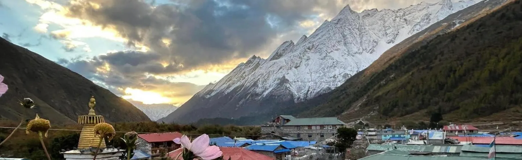
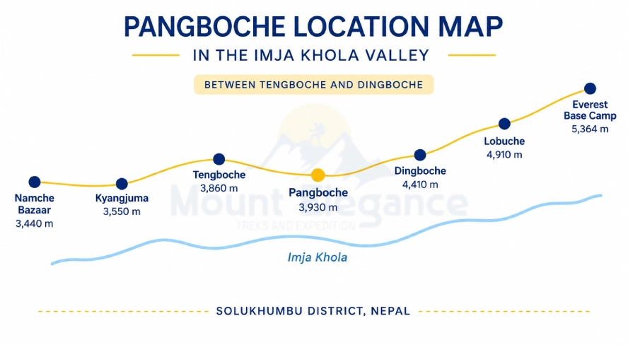
Pangboche is a Sherpa villager in the Khumbu region of Nepal at 3985m on the Everest Base Camp trekking route. Administratively part of Solukhumbu District, it sits along the trail between Tengboche and Dingboche making it a common stop for trekkers acclimatizing on their way toward Everest Base Camp or Ama Dablam Base Camp.
Pangboche is split into two distinct sections - the Upper Pangboche and Lower Pangboche each with its own character and cluster of teahouses - a structure that shapes much of how trekkers experience the village. It's also home to one of the Khumbu's oldest monasteries long associated with local legend including relics once claimed to be yeti remains adding a layer of culture intrigue to what is otherwise a quiet farming and trekking community. Between its monastery, mani walls and views of Ama Dablam towering overhead, Pangboche offers both a spiritual and scenic waypoint on the route to Everest.
Where Is Pangboche Located?
Pangboche sits in Solukhumbu District within Khumbu Pasang Lhamu Rural Municipality in Nepal's Bagmati Province in the Imja Khola valley. The village lies at approximately 27.82°N, 86.78°E, at an altitude of 3985m tucked into the slopes above the river as it winds down from the high glaciers near Everest.
Positioned directly between Tengboche and Dingboche, Pangboche serves as a natural waypoint for trekkers moving deeper into the Khumbu roughly a 3 to 4 hour walk from either neighboring village. It falls entirely within Sagarmatha National Park, the UNESCO-listed protected area that encompasses Everest and its surrounding peaks meaning the same park permit required elsewhere on the trek apply here as well. The village's elevated position offers sweeping views of Ama Dablam whose dramatic Pyramid shape dominates the skyline just to the south.
What Is Pangboche's Altitude?
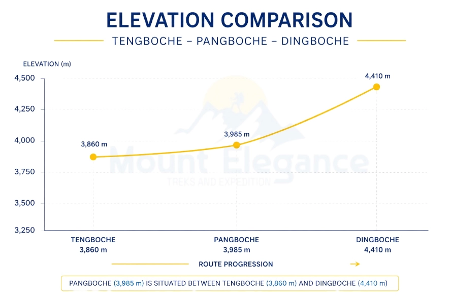
Pangboche sits at 3985m (13,074 ft) above sea level. That said, trekkers researching the village will sometimes come across different figures; some operators list altitudes closer to 3900m or even 3800m depending on which part of the village they're referencing.
This discrepancy comes down to Pangboche's Upper/Lower split. Lower Pangboche sits slightly below the main village center while Upper Pangboche climbs a bit higher on the slope near the monastery so the exact number quoted can shift by 50 to 100 meters depending on which section a guidebook or operator is describing. The commonly cited figure of 3985m generally refers to the main village area where most teahouses cluster.
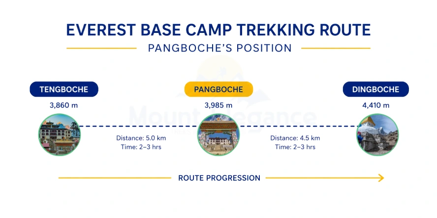
Sitting between Tengboche (3860m) and Dingboche (4410m), Pangboche functions as a useful acclimatization stop within Sagarmatha National Park giving trekkers a gentle gradual gain in elevation as their bodies adjust to the thinning air on the way toward Everest Base Camp.
What Is the Difference Between Upper and Lower Pangboche?
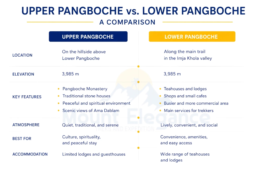
Pangboche splits into two distinct clusters Upper and Lower each serving a different role in the village.
Upper Pangboche - This is the older spiritual heart of the village home to the historic Pangboche Monastery and its famed yeti-relic legend. Traditional Sherpa stone homes weathered mani walls and prayer flags line its quieter pathways offering a glimpse into Khumbu religious life away from the main trekking bustle.
Lower Pangboche - This is the newer more trekker-oriented section built up around the demands of the Everest Base Camp route. It clusters teahouses, lodges and small shops along the mail trail giving hikers a convenient place to rest, eat and resupply before continuing toward Dingbouche.
How Do You Reach Pangboche?
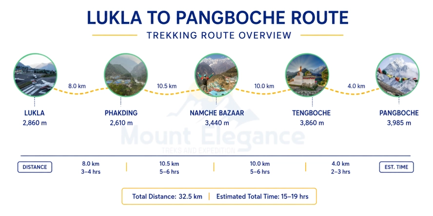
The only way to reach Pangboche is trekking from Lukla; no vehicle access exists anywhere along the route. As with the rest of the Everest Base Camp Trek the journey begins with a scenic flight from Kathmandu or Ramechhap into Lukla's Tenzing-Hillary airport, followed by several days of walking through the Khumbu.
From Lukla the trail runs through Phakding, Namche Bazaar and Tengboche before reaching Pangboche - a journey that typically takes 3 to 4 days at a standard acclimatization pace. The final stretch from Tengboche to Pangboche takes roughly 2 to 3 hours, descending through rhododendron forest before crossing the Imja Khola on a suspension bridge and climbing gently into the village.
This approach gradually on foot and build around acclimatization stops - is what makes reaching Pangboche part of the broader Everest Base Camp Trek experience rather than a standalone destination; most trekkers pass through on their way to Dingboche and eventually Base Camp.
What Is Pangboche Monastery Known For?
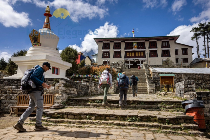
Pangboche Monastery was founded in the 17th century by Lama Sangwa Dorje, making it one of the oldest gompas in the Khumbu region. Situated in Upper Pangboche - it predates many of the more famous monasteries along the Everest Base Camp trail including Tengboche and holds a special place in local Sherpa Buddhist tradition as one of the region's original spiritual centers.
Inside, the monastery houses a collection of thangka paintings, aged statues, and rows of hand-turned prayer wheels, along with religious artifacts that have drawn pilgrims and curious trekkers alike, most notably what monks have long described as yeti skull and hand relics, though their authenticity remains widely disputed.
A small entry fee, collected by the monastery's local management committee, goes toward maintaining the building and supporting the resident monks. Beyond daily prayer, Pangboche Monastery plays an active role in Sherpa Buddhist festivals including Mani Rimdu - the vibrant masked-dance celebration also held at Tengboche drawing villagers and visitors together for a rare glimpse into Khumbu religious life.
What Is the Pangboche Hand?
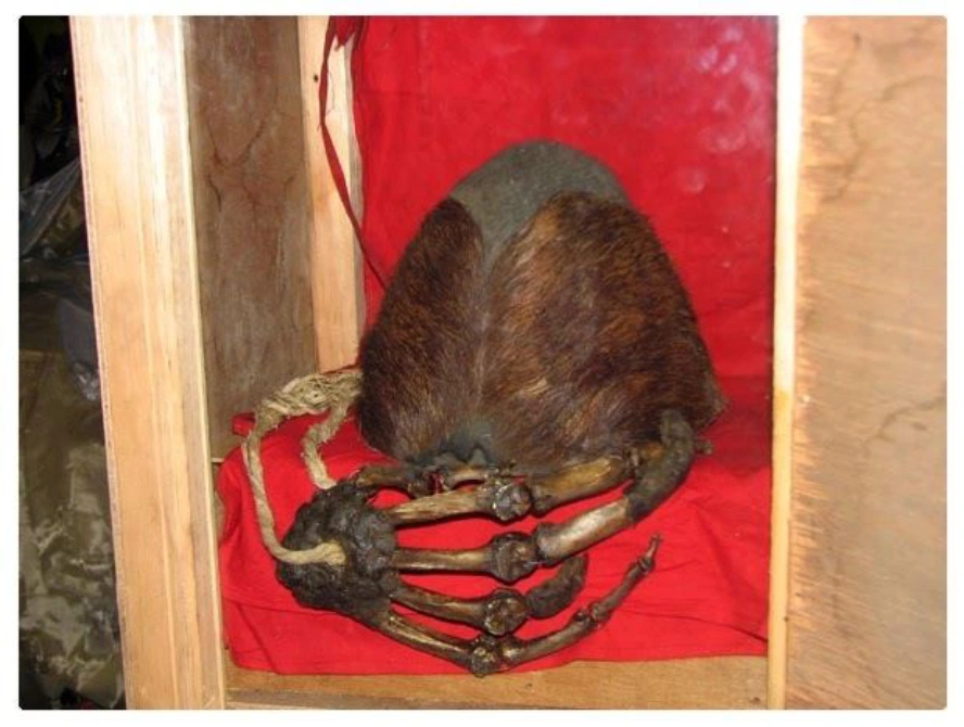
The Pangboche Hand is a relic once kept at the monastery and claimed locally to be the mummified hand and scalp of yeti. According to villager legend the relic traces back to Lama Sangwa Dorje himself said to have received it or encountered the creature centuries ago and it became one of the monastery's most closely guarded treasures.
The relic drew international attention in the late 1950s - when American oil tycoon and cryptozoology enthusiast Tom Slick funded expeditions to the Himalayas specifically to investigate reports of the yeti. During his 1957 to 1959 expeditions, a team member reportedly smuggled a finger bone from the hand out of Nepal for laboratory analysis, later famously spirited past customs with help from actor Jimmy Stewart.
Subsequent scientific testing including more rigorous DNA analysis decades later found that the hair and tissue matched not a yeti but a Himalayan serow - a goat-antelope species native to the region - effectively debunking the relic's mythical origin.
The original Pangboche Hand itself was stolen from the monastery in 1991 and never recovered. In 2011 New Zealand pilot Mike Allsop - working with special-effects studio Weta Workshop - had a detailed replica created and returned it to the monastery restoring a version of the relic and its legend to Pangboche.
What Is Sherpa Life Like in Pangboche?
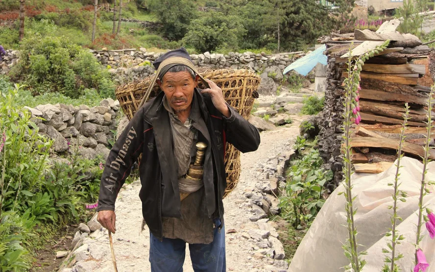
Farming and yak herding remain the dominant occupations for the Sherpa people of Pangboche
Shaping daily life around the rhythms of the seasons rather than the trekking calendar. Terraced fields near the village hardly produce high-altitude crops like - potatoes, barley and buckwheat staples that thrive in the thin air and rocky soil of the Khumbu.
Buddhist tradition runs deep here - visible in the prayer flags fluttering over rooftops, the mani walls lining the paths and the daily rhythms centered around pangboche Monastery. Festivals punctuate the calendar too, most notably Lhosar the Sherpa New Year celebrated with feasting, dancing and family gatherings that draw the community together in the depths of winter.
Food in Pangboche is homestyle and hearty meal - dal bhat (lentils and rice), thukpa (noodle soup) and momos (dumplings) are common fare often served in local-family-run teahouses that double as the village's social hubs.
Compared to Namche Bazaar the Khumbu's bustling trading center with its bakeries, bars and gear shops, Pangboche feels notably quieter and more traditional offering trekkers a more traditional offering trekkers a more grounded look at everyday Sherpa life away from the trail's more commercialized stops.
Where Can You Stay in Pangboche?
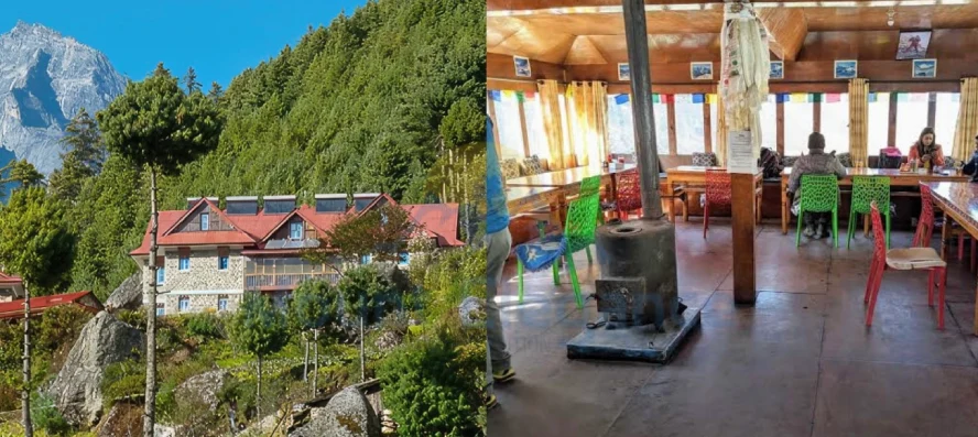
Accommodation in Pangboche consists primarily of family-run teahouses and lodges the standard lodging option throughout the Everest Base Camp trail. These simple guesthouses offer basic twin rooms usually with shared bathrooms though some now include private attached facilities at a higher price.
Amenities are modest but functional - hot showers are typically available for an extra fee, WiFi can be purchased through local providers through the connection is often slow and unreliable and evenings center around a communal dining hall warmed by a central stove where trekkers gather to eat, chat and thaw out after a day on the trail.
Food follows the standard Khumbu teahouse menu - dal bhat, noodle soups, fried rice, momos and simple pasta dishes alongside hot drinks like ginger tea and butter tea to help with acclimatization.
For trekkers seeking a bit more comfort higher-end options exist in the village as well including a branch of the well-known Everest Summit Lodge chain which offers sturdier construction, better heating and more reliable amenities than the typical base teahouse.
Basic medical facilities are also available nearby, useful given Pangboche's role as an acclimatization stop though anything beyond minor issues typically requires evacuation to better-equipped facilities in - Namche Bazaar, Pheriche or Kathmandu.
What Wildlife and Plants Are Found Around Pangboche?
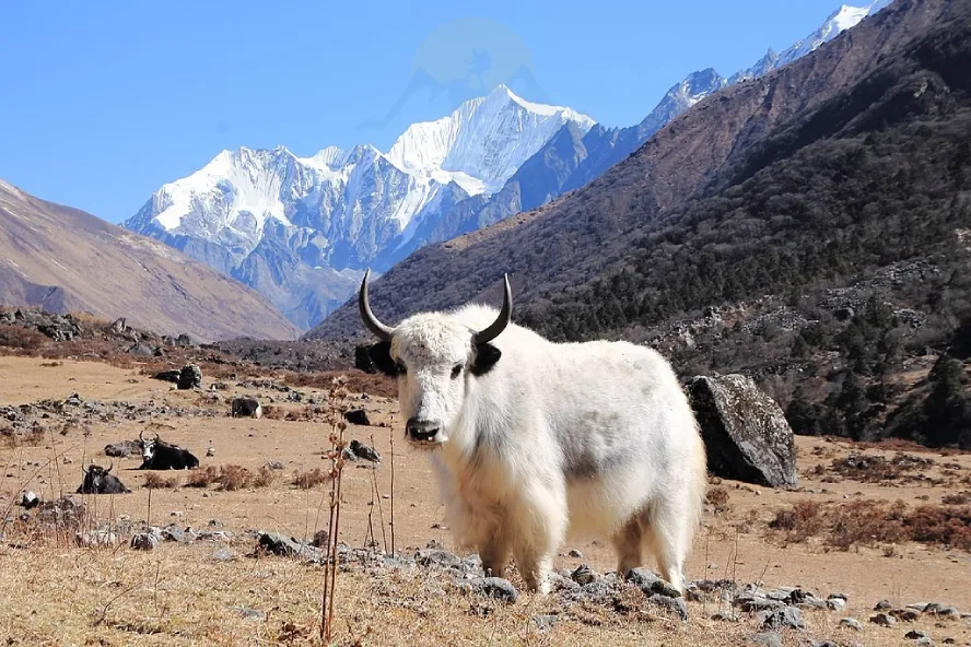
Sagarmatha National Park, which encompasses Pangboche and the surrounding Khumbu - is home to the Himalayan tahr - a wild goat species often spotted grazing on steep rocky slopes near the village. Beyond the tahr the park supports a range of high-altitude wildlife adapted to the thin air and harsh terrain.
Musk deer move quietly through the forested lower elevations of a small rabbit-relative. Dart between rocks near the village outskirts. Birdlife is equally notable in the Himalayan monal, Nepal's vibrant colored national bird is occasionally seen with its iridescent plumage flashing against the mountainside alongside the Himalayan snowcock whose distinctive calls echo across the high slopes at dawn.
Vegetables around Pangboche shift dramatically with the seasons. In spring rhododendron forests lower on the trail burst into vivid red, pink and whites, transforming the trail to the village into one of the most photographed stretches of the Everest Base Camp trek. By winter that same landscape turns bare and stark with leafless trees and frost-covered ground reflecting the harsher, quieter character of the high Khumbu in the colder months.
What Adventures Start From Pangboche?
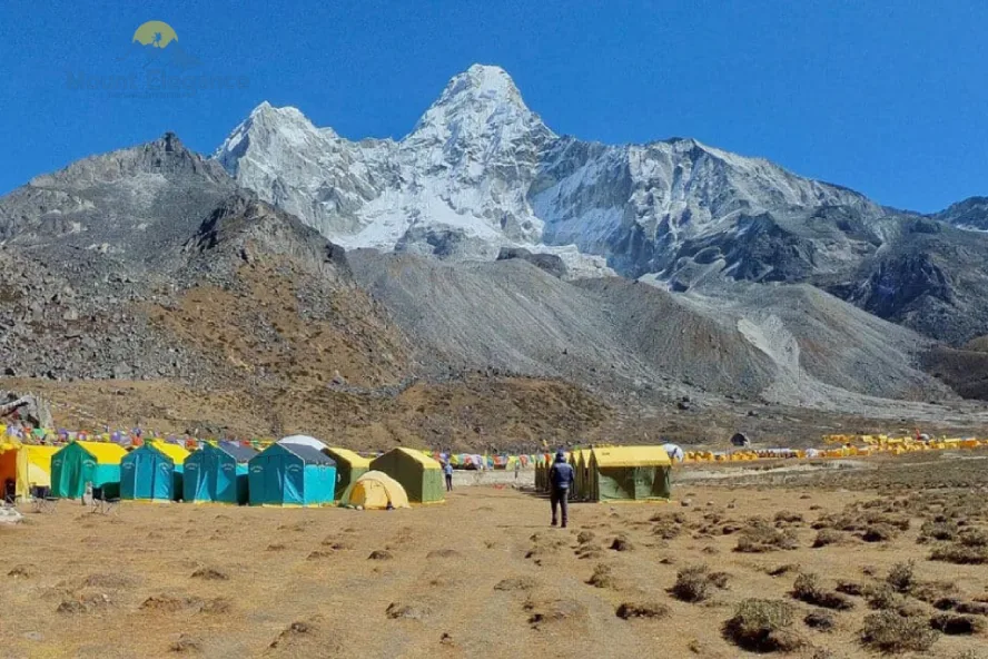
The primary side trip from Pangboche is the hike to Ama Dablam Base Camp - a round trip that takes roughly 6 to 7 hours and rewards trekkers with close-up views of the striking peak's fluted ridges and hanging glaciers. It's a popular acclimatization day hike for those with time to spare before continuing deeper into the Khumbu.
Beyond Ama Dablam, Pangboche also serves as a launching point for several more ambitious routes. Trekkers heading toward Island Peak or Chhukung branch off from the main Everest Base Camp trail here, following the Imja Khola valley southeast toward these popular climbing and viewpoint destinations. For those tackling the demanding Three Passes Trek, Pangboche can also mark the start of the route toward Kongma La, the first and often toughest of the three high passes.
Beyond its role as a waypoint, Pangboche functions as the last proper settlement before Ama Dablam's climbing terrain begins in earnest, making it the final stop for hot meals, teahouse beds, and reliable supplies before climbers head into the more remote, technical ground above.
When Is the Best Time to Visit Pangboche?
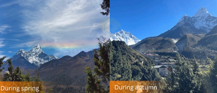
The two best seasons to visit Pangboche are spring (March to May) and autumn (September to November), both offering the most stable weather for trekking in the Khumbu.
Spring is known for its rhododendron blooms - the lower forests along the trail burst into color - with relatively mild temperatures for high altitude. Autumn is prized for clear skies; the post-monsoon air brings some of the best mountain visibility all year, along with drier trail conditions and sharp views of Ama Dablam.
Whatever the season, altitude sickness is a real risk at 3985m. A gradual ascent, with proper acclimatization days built in, plus staying well hydrated are the main ways to avoid AMS as the air thins.
If you're planning to visit Pangboche Monastery, a little etiquette goes far: dress modestly, cover shoulders and knees and always ask before taking photos, especially of monks or ongoing rituals - a simple sign of respect for the space.
Where Does Pangboche Fit on the Everest Base Camp Trek?
Pangboche sits between Tengboche and Dingboche on the standard Everest Base Camp Trek Route, making it one of the key waypoints in the trail's middle stretch. By this point most trekkers have already crossed the suspension bridges near Jorsale and climbed into Namche Bazaar - pangboche marks the next phase where the trail gains altitude more seriously and acclimatization starts to matter.
With a clear picture of what Pangboche itself offers the next step is understanding how it connects to the rest of the route - where it sits relative to Tengboche and Dingboche and what that means for planning the days around it.
Does the Everest Base Camp Trek Route Pass Through Pangboche?
Yes, the Everest Base Camp Trek Route passes through Pangboche typically Day 5 or 6 on the standard itinerary. It's usually scheduled as a lunch stop or overnight stay, positioned right after the walk down from Tengboche on the classic EBC route.
How Far Is Dingboche From Pangboche?
Dingboche is about 10km from Pangboche - roughly 3–4 hours of walking. Trekkers gain elevation from Pangboche's 3985m to Dingboche's 4410m along the way. This stage is commonly treated as a second acclimatization leg on the standard EBC itinerary.
How Far Is Kala Patthar From Pangboche?
Kala Patthar sits several days beyond Pangboche, reached via Dingboche, Lobuche, and Gorak Shep. On a standard itinerary, that's typically 3–4 more days of trekking from Pangboche before reaching Kala Patthar's summit viewpoint.


