What is Dingboche and Why Should Trekkers Care About It?
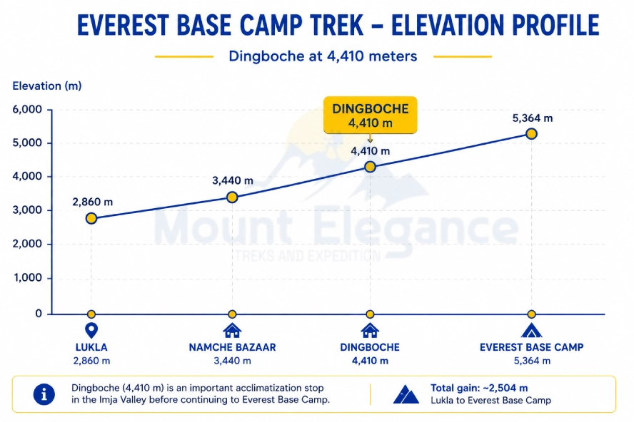
Dingboche is a remarkable stop on the way to Everest - the kind of place that earns its reputation quietly instead of announcing it. This small Dingboche village sits at roughly 4,410 meters altitude, tucked into the heart of the Khumbu region, and it doesn't really shout for attention the way a dramatic viewpoint or a famous monastery might. Still, ask any trekker who's done this route where the trip started feeling real, and there's a decent chance this is the place they'll bring up.
A lot of that comes down to timing. Push deeper toward the Everest Base Camp gateway, and the body starts asking for more than just forward progress - it needs somewhere to pause, adjust, let the altitude catch up with the ambition. Dingboche has quietly turned into exactly that kind of stop, an acclimatization hub that's become almost baked into the trek's rhythm out of sheer necessity.
Then there's who actually lives there. As a genuine Sherpa settlement, Dingboche carries the same warmth found throughout the rest of the Khumbu, even this high up and this far from anything resembling a city. Add in the wide views back toward Ama Dablam and the surrounding peaks, and it starts to make sense why this trekking destination ends up meaning more to people than its size, or its brief stop on the itinerary, would ever suggest.
Where exactly is Dingboche located in Nepal?
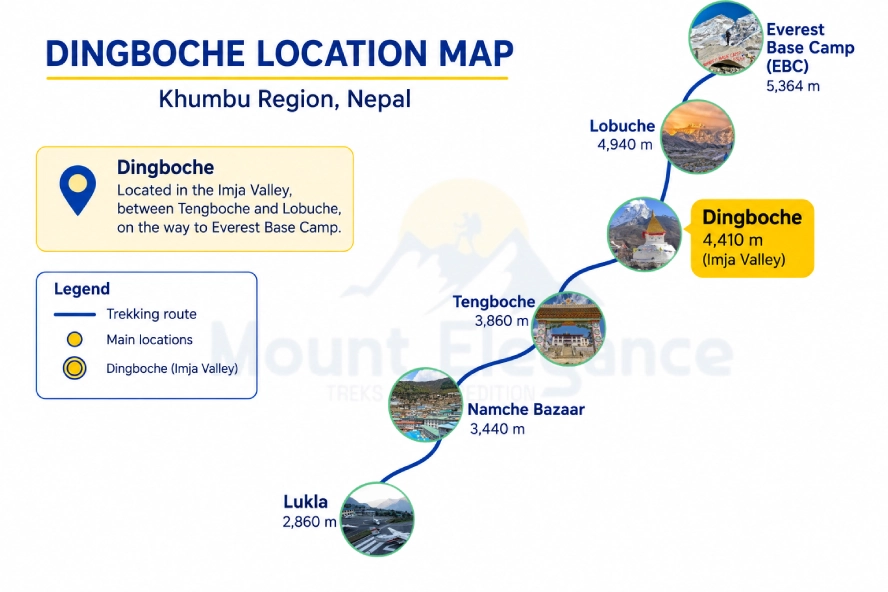
Located in the heart of the Khumbu region, Dingboche isn't the kind of place you stumble onto by accident - reaching it takes days of walking through some of the most dramatic terrain in the Himalayas. Tucked into the Imja Khola valley, the village sits off the main trail that most trekkers follow toward base camp, occupying a quieter branch that peels away into Southeastern Khumbu territory.
As a genuine high altitude village, its position says a lot about the practical demands of travel in this part of the world. Nothing about Nepal geography here is flat or convenient - villages exist where the terrain allows them to, wedged between ridgelines and river valleys rather than laid out on any kind of grid. Dingboche's specific spot, framed by peaks on nearly every side, is a fairly typical example of how settlements in this Himalayan location tend to form: around water, around a break in the terrain, and around whatever flat ground the mountains happen to offer.
What altitude is Dingboche and how does it affect trekkers?
At 4,410 meters - about 14,470 feet Dingboche sits high enough that the air itself starts to feel different, even before anyone's told what number to expect. Conversations slow down slightly. Simple tasks like unpacking a bag take a beat longer than they should. None of it is dramatic on its own, but together it's the body's quiet way of announcing that it's operating somewhere it wasn't really built for.
That's really the whole story behind why this stop matters so much. The various high altitude effects - headaches, disrupted sleep and persistent slight breathlessness don't announce themselves with much warning, which is exactly why altitude sickness prevention leans so heavily on pacing rather than willpower. Trekkers who treat Dingboche as just another box to tick tend to be the ones who feel it hardest a day or two later.
The acclimatization importance built into this stage isn't an abstract guideline, it's the difference between a trek that continues comfortably and one that gets cut short entirely. Give the body a day here, let real altitude adaptation take hold, and the rest of the route becomes far more manageable than pushing straight through ever would.
Which mountains are visible from Dingboche?
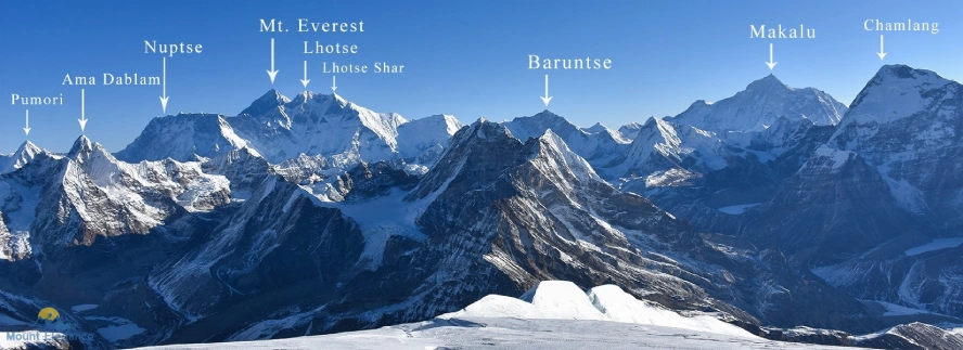
From Dingboche's spot in the Imja Khola valley, trekkers get some genuinely great panoramic views, with several major peaks all visible at once:
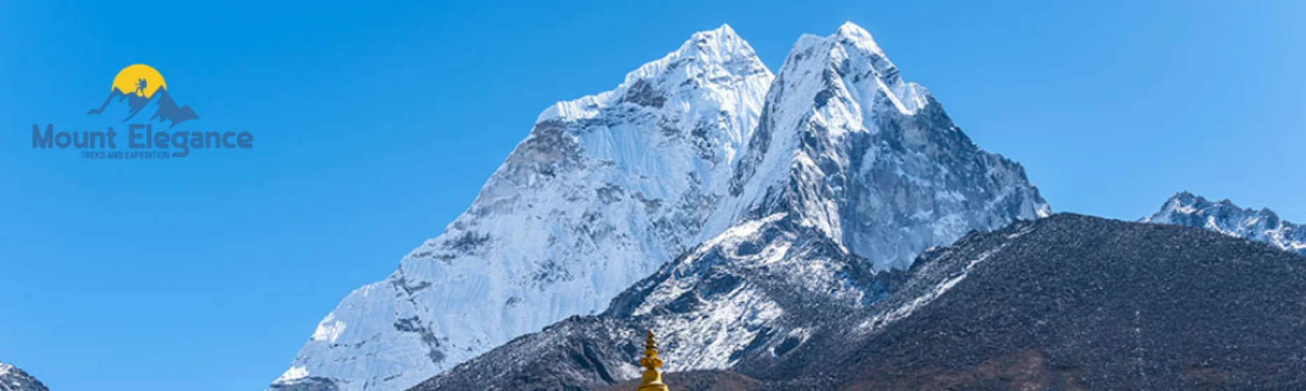
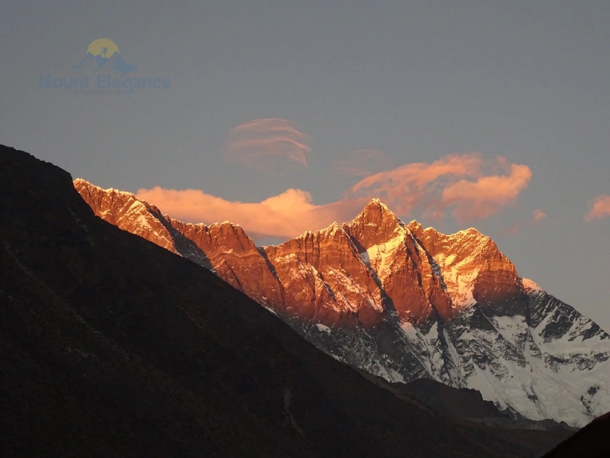
- Ama Dablam - the real showstopper here. Its sharp, unmistakable spire dominates the skyline just south of the village and gets called one of the most photogenic peaks anywhere in the Himalayas, for good reason.
- Lhotse - the world's fourth-highest mountain, sitting further up the valley, its huge rock face easy to pick out from the peaks around it.
- Makalu - catches the eye from a few spots around Dingboche and nearby ridges, thanks to that unmistakable pyramid shape.
- Thamserku - climbs sharply to the south, part of the dramatic wall of rock that frames the village from below.
- Nuptse - shows up partially alongside Lhotse, adding to the row of high peaks lining the upper valley.
- Island Peak (Imja Tse) - visible further along toward Chukhung, and a favorite climbing objective in its own right for trekkers already dreaming about the next trip.
Put all of that together and you get properly striking mountain scenery which goes a long way toward explaining why so many trekkers end up sticking around Dingboche longer than the itinerary technically calls for.
What is the weather like in Dingboche throughout the year?
Weather in such high altitude is determined by the high-altitude environment, where conditions can shift rapidly and differ significantly from standard forecasts.
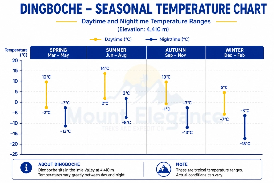
Spring weather running roughly March through May, brings some of the most trekker-friendly conditions of the year. Daytime temperature ranges typically sit between 10°C and 15°C, dropping to around -5°C to -10°C overnight. Skies are generally clear early in the season, though afternoon clouds tend to build up as spring progresses.
Autumn season from September through November, is widely considered the best season for trekking. The air clears dramatically right after the monsoon, delivering the sharpest mountain views of the year. Daytime temperatures run similar to spring, around 10°C to 12°C, though nights can dip further, sometimes down to -15°C.
The monsoon period, from June through August, brings a completely different feel - heavy cloud cover, frequent rain lower down the valley, and generally poor visibility for mountain views. Daytime temperatures stay relatively mild, often 12°C to 16°C, but the near-constant precipitation patterns make trekking conditions genuinely unpleasant, which is why almost nobody attempts this route during these months. Winter conditions, from December through February, are the harshest by far. Daytime highs often struggle to clear 0°C to 5°C, and nighttime temperatures regularly plunge below -15°C, occasionally reaching -20°C or lower. Snowfall is common, and while the skies tend to stay dry and clear, only well-prepared, experienced trekkers should consider this season.
When is the best time to trek to and through Dingboche?
The best time comes down to two real contenders: Spring season (March-May) and Autumn season (Sept-Nov), both offering the strongest weather stability and the best trekking feasibility of the year.
Factor | Spring (March-May) | Autumn (Sept-Nov) |
Clear skies | Good early on, more afternoon cloud later in the season | Consistently strong, especially right after monsoon |
Visibility | Solid, improves toward May | Sharpest of the year, best mountain views |
Weather stability | Fairly reliable, some late-season shifts | Most stable window overall |
Crowding patterns | Busy, especially April | Busiest season on the trail |
Bonus | Rhododendrons blooming lower in the valley | Freshest air right after the rains |
In practice, autumn edges out spring for pure visibility and consistency, since the monsoon clears the air just before the season starts and rarely lets cloud build back up the way late spring sometimes does. That said, autumn's crowding patterns are the heaviest of the year, with lodges filling up fast and the trail feeling noticeably busier than in spring. Trekkers chasing the clearest possible views should lean autumn; those wanting slightly thinner crowds, with still-solid conditions, often do just as well picking spring instead.
What's the trekking route to reach Dingboche?
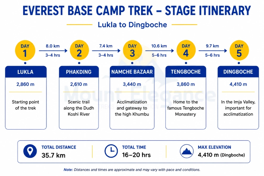
The journey to Dingboche follows a fairly standard trekking itinerary that most Everest-bound trekkers end up walking in more or less the same order. It kicks off with a short Lukla flight from Kathmandu - the real gateway into the Khumbu and the actual starting line for the walk itself. Day one is a gentle warm-up, dropping down to the riverside village of Phakding, giving legs and lungs a bit of time to settle into the trail's rhythm before anything demanding shows up.
Day two changes the tone entirely, with a longer, steeper climb up to Namche Bazaar, the region's main trading hub, where most itineraries build in a rest day specifically for early acclimatization. Leaving Namche, the trail drops back down toward the river before climbing right back up to Tengboche, home to the valley's famous monastery and widely considered one of the tougher single days on the whole route. From there, the path pushes steadily further up the valley, gaining altitude bit by bit until Dingboche finally comes into view.
Daily distances on this stretch usually run 10 to 15 kilometers, though that number matters far less than the elevation gained along the way. Total trek duration from Lukla to Dingboche typically lands around 4 to 5 days, and trail difficulty stays moderate throughout - nothing technical, but the mix of steady climbing and thinning air makes pacing matter more than raw fitness ever will.
Why is Dingboche crucial for acclimatization on EBC trek?
Dingboche serves as one of the two main rest days built into the standard Everest Base Camp itinerary, and its role in altitude acclimatization is hard to overstate. Sitting at 4,410 meters, it's positioned right where the trek starts pushing into genuinely serious altitude territory, making it a critical checkpoint for body adaptation before the trail gets even higher.
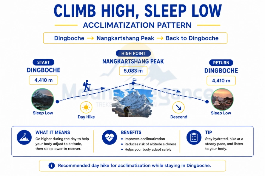
The standard approach here follows the classic acclimation strategy of "climb high, sleep low" - most trekkers spend their rest day hiking up toward Nagarjun Hill or Chukhung Ri during daylight, then return to Dingboche's altitude to sleep. That short excursion higher, followed by a return to lower ground for rest, helps trigger real physiological adjustment rather than just passive waiting around.
This matters because altitude sickness prevention isn't optional past a certain elevation - it's the difference between a manageable trek and a genuinely dangerous one. Skipping proper gradual ascent through stops like Dingboche significantly raises the risk of severe complications, including High Altitude Cerebral Edema (HACE) and High Altitude Pulmonary Edema (HAPE), both of which can turn life-threatening fast if the body hasn't had time to adjust. Dingboche's rest day isn't a scheduling nicety, it's a genuine safety measure built into the trek for good reason.
What is the Sherpa culture like in Dingboche?
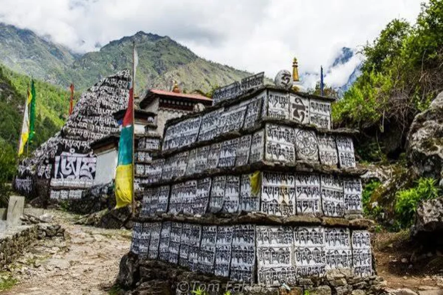
The Sherpa people of Dingboche carry forward a way of life shaped by centuries of high-altitude living, deeply woven into Buddhist traditions and the rhythms of a landscape that leaves little room for anything soft-edged. Even in a village this small, that identity comes through clearly in daily life, in the built environment, and in how visitors are treated the moment they arrive.
Walk through the village and prayer flags are everywhere, strung between lodges and stupas, fluttering constantly in the near-permanent wind that sweeps through this part of the valley. Small chortens and mani walls line the paths, quiet reminders of the spiritual beliefs that shape daily routine here as much as farming or trekking work does. While Dingboche itself doesn't host a major monastery the way Tengboche does, nearby monasteries and shrines remain part of the community's regular religious life.
Local customs here center heavily on hospitality offering tea, checking in on tired trekkers, making space at a packed dining table without a second thought. It's not performative; it's just how things work in a Sherpa community this remote. Even the traditional architecture reflects the environment directly, with thick stone walls and low, sturdy rooflines built specifically to survive brutal wind and cold. Altogether, the Sherpa community in Dingboche offers a genuine, lived-in glimpse of Himalayan culture rather than anything staged for passing trekkers.
What do the local people of Dingboche do for a living?
Dingboche's economy rests on two pillars that have supported life here for generations, now joined by a third that's reshaped the village entirely. Traditional agriculture remains part of daily life, though at this altitude the options are limited. Potato farming dominates, since potatoes tolerate the thin soil and short growing season far better than most crops. Barley crops also get planted in smaller quantities, another staple that survives the harsh conditions where little else would.
Alongside farming, yak herding has always played a central role in sustaining the village. Livestock, mainly yaks and yak-cattle hybrids known as dzo, provide transport, dairy, wool, and dried dung used for fuel - a genuinely essential resource in a place with no other reliable heating source. Families have managed herds across these high pastures for generations, moving animals seasonally as grazing conditions shift.
More recently, tourism has become the dominant source of income for much of the village. The hospitality business - running teahouses, guiding treks, working as porters, now provides the bulk of local employment, especially for younger residents. Farming and herding haven't disappeared, but tourism has clearly become the economic engine keeping Dingboche viable as a year-round settlement rather than just a seasonal herding stop.
What are the best attractions and day hikes around Dingboche?
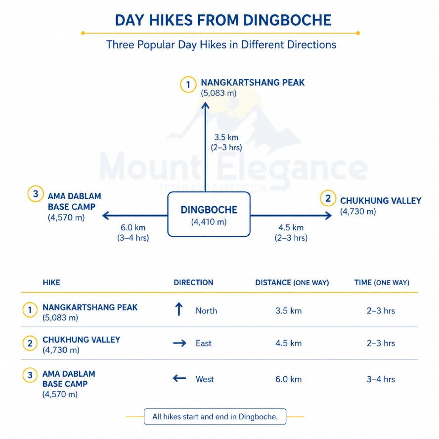
From Dingboche, several excellent day hikes branch out into the surrounding valley, giving trekkers both acclimatization benefits and some of the best scenery on the whole route:
- Nangkartshang Peak - The most popular acclimatization hike directly above the village, climbing to roughly 5,083 meters. It's steep but doesn't require technical skill, and the summit delivers sweeping views of Ama Dablam, Makalu, and the valley below - making it the default choice for Dingboche's rest day.
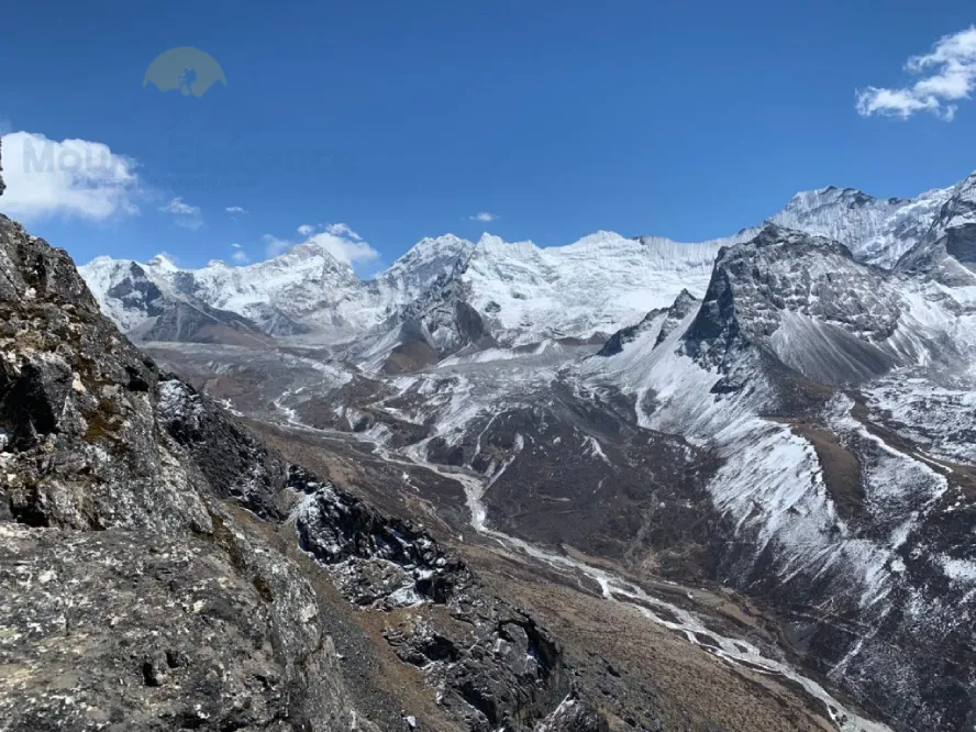
- Chukhung Valley - A quieter, less-trodden branch of the trek that splits off toward Island Peak territory. This detour trades some of the crowds for a more remote feel, following the Imja Khola further up the valley.
- Chukhung Ri - Reached via Chukhung Valley, this viewpoint sits even higher and rewards the extra effort with one of the closest, most dramatic looks at Lhotse and Nuptse anywhere on the trek.
- Ama Dablam Base Camp - A worthwhile side trip for trekkers with an extra day, offering an up-close view of the mountain's famous ridgeline that's simply not available from the main trail.
- Tengboche Monastery - Though technically already passed on the way up, some trekkers factor in a return visit or extended stop here, drawn back by the monastery's atmosphere and the mountain views from its grounds.
These hiking routes and other trekking detours around Dingboche give trekkers real flexibility, a chance to build in extra acclimatization, chase quieter trails, or simply see more of the valley before pushing on toward base camp
Nangkartshang Peak Trek
The trek to Nangkartshang climbs steadily out of Dingboche onto the ridge above it. As a 5-6 hour round trip, it's a genuine acclimatization hike, though rewarding well beyond that purpose alone. The path isn't technical, but the physical challenge comes from steep ground combined with thinning air near the top. The summit delivers stunning mountain views - Ama Dablam and peaks stretching across the horizon, plus a real altitude experience at 5,083 meters that makes the effort feel worth it immediately.
Chukhung Valley Extension
Chukhung Valley offers a beautiful valley trek for trekkers who want to explore a peaceful trail of the Everest region. One major advantage isthat access to Island Peak is easy, making it a useful stop for climbers preparing for an Island Peak expedition. It also gives a Three Passes Trek connection, allowing experienced trekkers to extend their route and explore more of the Khumbu region. The peaceful environment makes it suitable for remote trekking, with fewer trekkers than popular sections of the Everest Base Camp route. However, this extension requires additional days, which may not suit travelers with a limited time schedule. Higher elevation, long walking hours, and basic facilities can also make this trek more demanding.
Ama Dablam Base Camp Trek
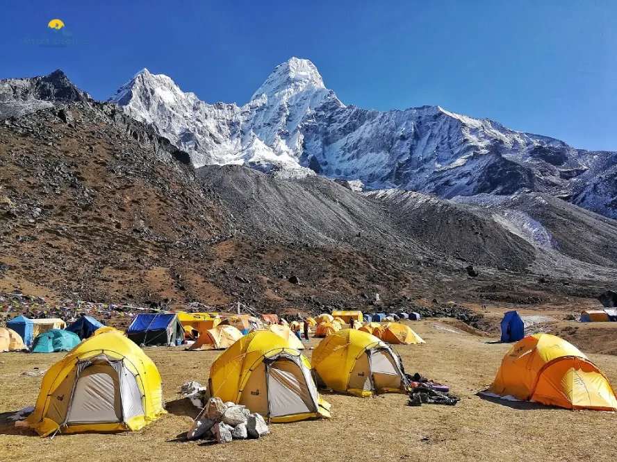
Ama Dablam Base Camp Trek offers a rewarding journey toward one of Nepal’s most amazing peaks. The path takes hikers close to Ama Dablam, a pyramid mountain often called the Matterhorn of Himalayas because of its unique shape. This base camp trek gives chances for photography with stunning mountain views, rocky areas and traditional Sherpa villages along the way. Good physical fitness is required because there are long days of continuous walking and the altitude keeps rising. Even though it is hard, getting to Ama Dablam Base Camp gives a scenic reward with a powerful view standing above the other Himalayan peaks. It is an option for hikers who want a tough path with beautiful scenery and a closer look at one of the famous mountains in the area. This trek can also be an incredible photography opportunity for travelers seeking uncrowded, pristine Himalayan landscape.
What accommodation options are available in Dingboche?
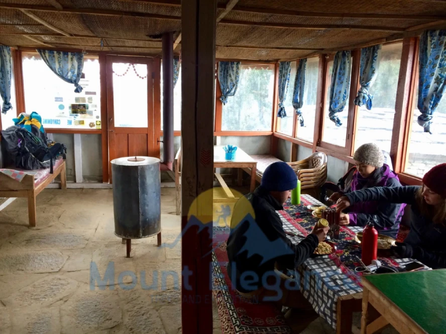
Dingboche offers different simple accommodation options for trekkers, mainly teahouses and lodges along the main trail. Most places provide basic rooms with beds, mattresses, and warm blankets to help guests stay comfortable and warm in the cold mountain weather. Shared bathrooms are common, especially in smaller lodges, while hot showers may be available for an extra charge. Trekkers usually sit around the communal dining room to eat meals, warm up, and meet other travelers. Here the facilities are limited, these teahouses provide simple amenities which are suitable for high-altitude trekking. What makes a stay in Dingboche special is Sherpa hospitality, with a friendly local welcoming atmosphere even being in the remote mountain setting.
What food is available to eat in Dingboche?
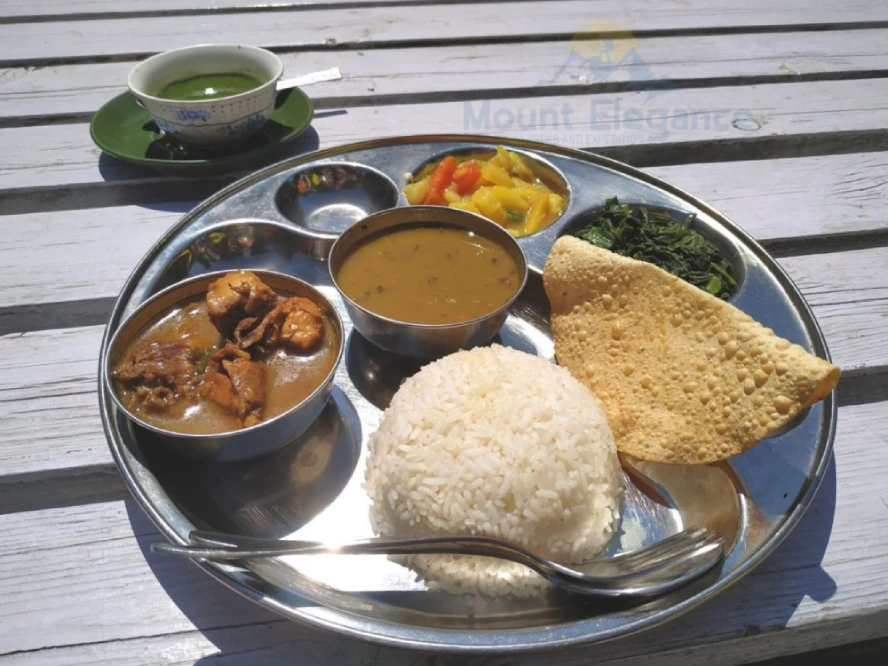
Dingboche's menu usually includes meals that are suitable for trekkers walking at high altitude. Dal Bhat is a popular choice, usually served with- rice, lentils, vegetables, and sometimes curry. You can also try local dishes such as- Sherpa stew along with noodles, pasta, soups, and fried rice. Butter tea is a warm local drink that can be comforting in the cold mountain weather and yak cheese is available as a snack or added to some meals. Trekkers can choose energy foods such as- eggs, potatoes or snacks during long walking days. These high-calorie meals provide useful fuel for trekking making Dingboche’s food suitable as altitude food for travelers continuing toward higher elevations of the Everest region.
Is there Wi-Fi and how reliable is connectivity in Dingboche?
While Dingboche has internet availability, except spotty Wi-Fi and limited service Many teahouses offer Wi-Fi, but speeds can be slow, especially during peak season or bad weather conditions. Phone connectivity may also be weak or limited, with signal weakness in some areas. It is best to download important files, maps, and messages before arriving. With limitedservice, Dingboche can naturally become a short digital detox, so prepare to stay offline for parts of your trek.
Why should every Everest Base Camp trekker stop in Dingboche?
Dingboche is not just a rest day village - but a well-planned essential stop for safe and comfortable Everest Base Camp trek. The trails and extra time will help trekkers adjust themself and support healthy acclimatization at higher elevation. The village also offers an unforgettable trekking experience that includes culture immersion of Sherpa life and stunning mountain views of peaks such as - Ama Dablam and Lhotse. It is often known as a Himalayan gem that creates unforgettable memories and gives you gate-way experience toward higher sections of the Everest region.

What should trekkers pack specifically for Dingboche?
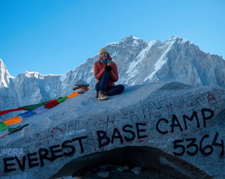
For Dingboche you need to pack comfortable, warm layered clothes and better cold-weathergear because temperatures can drop very quickly especially at night. Thermal clothing helps you stay warm and keeps your body temperature under control while good-quality hiking boots give you the grip you need on uneven trails in higher elevation. Don't forget sun protection like sunglasses, sunscreen and a hat to protect yourself from UV rays, which can be strong at altitude. Bring any altitude medication that your doctor has prescribed along with things like water bottles and a headlamp. Good altitude preparation means packing light but making sure you are ready for dry air and changing mountain conditions.
Does Dingboche have any historical importance in mountaineering?
Dingboche is an important stop for trekkers who like mountaineering history. It is on the way to Everest and trekkers have been stopping here for a time before they head towards higher elevation. Edmund Hillary and Tenzing Norgay were like Everest pioneers . They showed everyone how great this place was. The Sherpa legacy of helping people who climb or summit Everest. They are still doing it to date. Today, people can still walk on the trails and stay in the same lodges where Edmund Hillary and Tenzing Norgay took rest before continuing for Mt Everest, and it feels like you are a part of the expedition heritage and the mountaineering history of the Himalayas.
Are There Alternative Everest Base Camp Trek Routes Besides Dingboche?
There are alternative Everest Base Camp trek routes besides Dingboche, which offer different scenery and experiences. Trekkers can take the Gokyo Lakes Route and cross Cho La Pass before connecting the trail to Everest Base Camp, or take a quieter trail through Phortse. Another option is staying in Pheriche instead of Dingboche for a rest day. Experienced trekkers can choose the Three Passes Trek, crossing Renjo La- Cho La and Kongma La before reaching Everest Base Camp. While Dingboche remains a popular acclimatization stop, these alternatives provide more landscapes, quieter trek trails, and additional Himalayan adventure.
Can You Reach Everest Base Camp Without Flying Into Lukla?
Yes you can reach Everest Base Camp without flying to Lukla by driving 8 to 10 hours from Kathmandu to Salleri, Phaplu or Tham Danda by jeep or take an old Hillary-Tenzing route starting from Jiri.
Are There Quieter Alternatives Near Namche Bazaar?
Yes, several peaceful alternatives sit just a short hike away from the bustling hub of Namche Bazaar such as - Khumjung, Khunde, Thame, Syangboche and Phortse.
Can Trekkers Bypass Tengboche on the Way to Gokyo Lakes?
Yes, trekkers heading to Gokyo Lakes naturally bypass Tengboche. The standard trail to Gokyo splits off from the main EBC route at Sanasa or Namche, leading north through Dole and Machhermo, bypassing Tengboche entirely.
Is There Any Way to Skip Gorak Shep on the Everest Base Camp Trek?
No - Gorak Shep is unavoidable. It's the last settlement before both Everest Base Camp and Kala Patthar, and there's no alternate route or shortcut around it. Every standard EBC itinerary uses it as the final overnight base for both destinations.