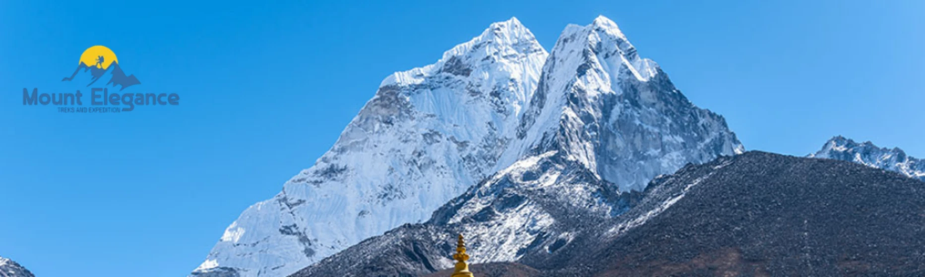
Pheriche is a village at 4240m (13910 ft) in the Khumbu region for Pheriche Nepal sitting directly on the Everest Base Camp trail known best for its Himalayan Rescue Association aid post. This small Sherpa settlement is home to roughly 150 residents making it one of the more compact stops along the standard Pheriche village Everest itinerary, tucked into a wide wind-exposed valley beneath Ama Dablam.
At this Pheriche altitude the villager sits well within serious high-altitude territory which is exactly why the Himalayan Rescue Association chose it as the site for its original aid post back in 1973. The post operates during the two main operating trekking seasons - spring (March to May) and autumn (October to December) - staffed by volunteer doctors who treat trekkers, porters and local Sherpa residents alike. Free daily lectures on altitude sickness are held here throughout the season and the post remains the only proper medical facility in the upper Khumbu Valley closer to Everest than any other clinic in the region.
Beyond the medical post, Pheriche functions much like the other Khumbu villagers along the trail: a cluster of teahouses, a scattering of stone homes and grazing yaks scattered across the valley floor. Most trekkers pass through here either on the way up toward Dingboche and Lobuche or use it as an alternative acclimatization stop to Dingboche since both villagers sit at a similar elevation on parallel branches of the trail.
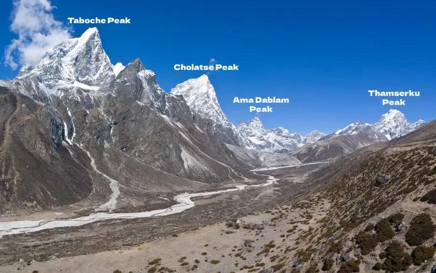
Life in Pheriche follows the same rhythm as much of the upper Khumbu - herding seasonal tourism work and a heavy reliance on the trekking season for income. Given its exposed position and thin air the village can feel bleak on a cloudy day and stunning on a clear one with Taboche and Cholatse rising sharply above the valley For trekkers dealing with early symptoms of altitude sickness, Pheriche often becomes an unplanned but genuinely valuable stop offering both rest and expect medical guidance before continuing higher toward Everest Base Camp.
Where Is Pheriche Located in the Khumbu?
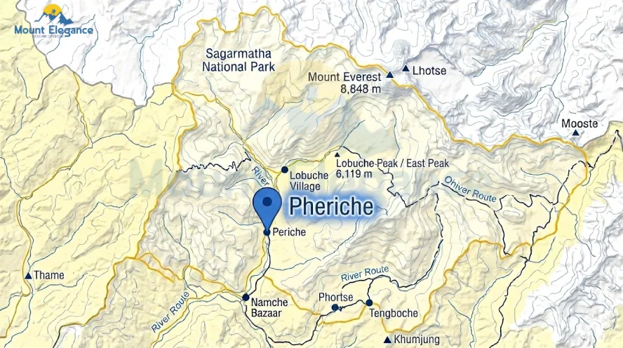
Pheriche sits in Nepal’s Solukhumbu District inside Sagarmatha National Park on the classic Everest Base Camp trail between Pangboche and Tengboche below and Dingboche above. The village rests above the Khumbu Khola, the glacial river that carries meltwater down from the peaks surrounding Everest. Unlike the steep forested trails, sections lower down Pheriche opens into a wide, flat, treeless valley shaped by centuries of glacial movement. The land here is exposed and windswept with little to block the cold air that sweeps down from the surrounding mountains.
Because Pheriche falls within Sagarmatha National Park, a UNESCO World Heritage Site the surrounding land and Wildlife are protected and trekkers passing through are technically inside the park’s boundaries this location tucked between two major trail junctions makes Pheriche a natural stopping point for anyone following the standard Khumbu region map toward base camp. Its position on the valley floor rather than a hillside also sets it apart from rather than a hillside also sets it apart from many other Khumbu villagers along the route.
How High Is Pheriche? (Altitude Explained)
Pheriche sits at 4240m (13910 ft) placing it firmly in high-altitude terrain on the Everest Base Camp trail. Different maps and GPS devices sometimes list slightly different numbers usually off by a few meters but 4240 meter is the figure most commonly used by trekking agencies and altitude charts. This small variance comes down to measurement methods and rounding not any real change in the villager itself.
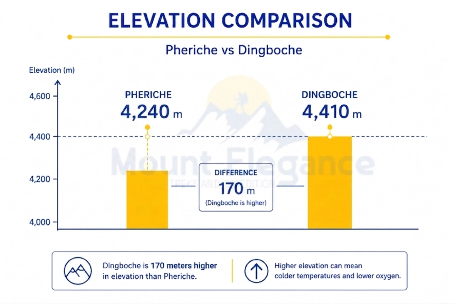
At this height the air holds noticeably less oxygen than at sea level which is part of why altitude sickness becomes a real concern for trekkers passing through Dingboche the parallel acclimatization stop on the other branch of the trail sits slightly higher at 4410 m through the difference between the two is advantage over the other for adjusting to elevation.
Pheriche’s altitude is also the reason the Himalayan Rescue Association chose it for their aid post. Being this high up close to Everest but still low enough for meaningful acclimatization makes the villager a practical checkpoint for anyone continuing higher toward base camp.
Why Do Sources List Two Different Altitudes for Pheriche?
Pheriche spans a sloping valley so lodges at the lower end sit near 4240 m while the upper end reaches 4240 m. This isn’t a measurement error - it’s simply a villager that stretches along a slope rather than sitting at a single point. Lower lodges near the river read closer to 4240 m while teahouses toward the upper part of the village climb closer to 4240 m. For trip planning 4240 m is the working number most guides and agencies use since it reflects elevation. Neither figure is wrong; they just describe different points along the same settlement.
How Do You Reach Pheriche from Lukla?
Day | Route | Approx. Altitude |
Day 1 | Lukla to Phakding | 2610 m |
Day 2 | Phakding to Namche Bazaar | 3440 m |
Day 3 | Acclimatization day in Namche Bazaar | 3440 m |
Day 4 | Namche Bazaar to Tengboche | 3860 m |
Day 5 | Tengboche to Pangboche to Pheriche | 4240 m |
What Is the Himalayan Rescue Association (HRA) Aid Post in Pheriche?
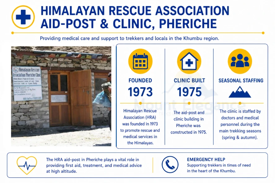
The Himalayan Rescue Association (HRA) aid post is a volunteer- staffed clinic in Pheriche that treats and helps prevent altitude sickness among trekkers, porters and local residents. The HRA was founded in 1973 and the Pheriche clinic was built in 1975 with support from Japanese donors. The post operates only during the two main trekking seasons spring (March to May) and autumn (October to December), staffed by international volunteer doctors who donate their time to work at altitude.
Each afternoon during the season the clinic runs a free talk on altitude sickness covering symptoms, prevention and when to descend. Beyond routine care the post also played a critical role during the 2015 earthquake serving as a relief point for injured trekkers and residents in the upper Khumbu when access to the region was cut off.
Why Does Pheriche Matter for Acclimatization?
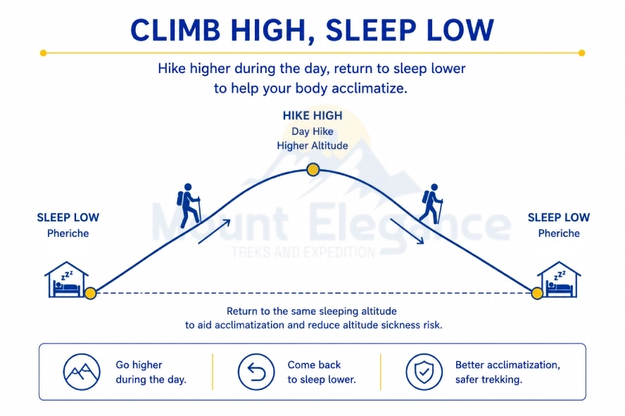
Pheriche’s altitude and trail position make it a mandatory acclimatization stop before or after the trek’s highest sections. The village puts the climb high sleep low principle into practice: Trekkers hike to a higher point during the day then descend to steep at Pheriche’s lower elevation which trains the body to handle reduced oxygen without pushing it too far too fast. A night spent here supports the body’s production of red blood cells, a key adaptation that improves oxygen-carrying capacity at altitude.
What Short Hikes Help You Acclimatize Near Pheriche?
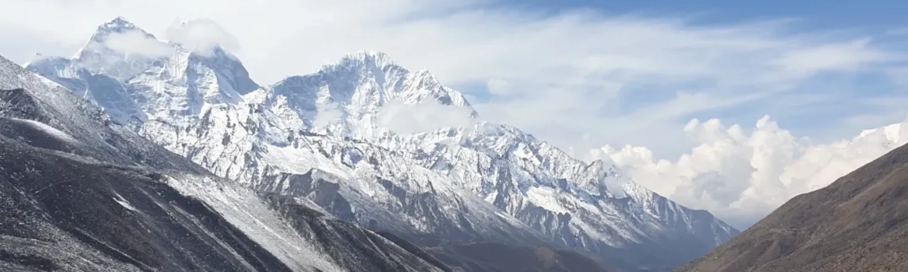
The ridge viewpoint hike above the village is the main acclimatization walk near Pheriche taking about one hour to complete. From the top trekkers get open views of surrounding peaks such as Ama Dablam, Taboche, Cholaste and Themserku each rising sharply above the valley. The walk is short but steep enough to elevate the heart rate and support the acclimatization process making it a common choice for trekkers spending a rest day in the village. No technical experience is needed, just sturdy boots and a slow steady pace suited to the thin air.
Pheriche vs Dingboche: Which Should You Stay In?
Dingboche generally suits trekkers on the way up while Pheriche works better for those descending or recovering. Both villages sit at a similar elevation on parallel branches of the trail, but Dingboche’s setting offers more varied terrain for acclimatization hikes making it the common choice for the outbound leg toward base camp. Pheriche with its flatter valley floor and closer access to HRA aid post tends to suit trekkers heading back down or dealing with early altitude symptoms who want rest and medical guidance close at hand.
What Are the Key Differences Between Pheriche and Dingboche?
Feature | Pheriche | Dingboche |
Altitude | 4240 m | 4,410 m |
Weather | More wind-exposed, colder | More sheltered |
Medical care | HRA aid post | MMI clinic |
Side-hike options | Ridge viewpoint hike | Nangkartshang Peak |
Best used for | Descent, recovery | Ascent, acclimatization |
Should You Stay in Dingboche Going Up or Pheriche Coming Down?
Most itineraries sleep in Dingboche on the ascent and Pheriche on the descent. This route suits standard EBC trekkers following the classic itinerary, those prioritizing varied acclimatization hikes on the way up, and trekkers wanting proximity to the HRA aid post while descending. Guided groups and independent trekkers both commonly follow this same ascent-descent pattern.
What Is the Weather Like in Pheriche? (Best Time to Visit)
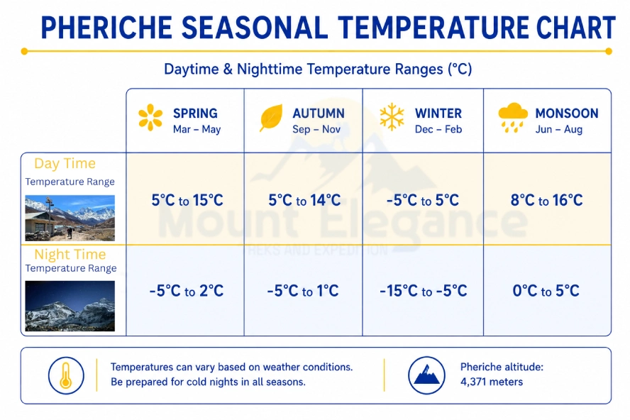
Spring (March - May) and autumn (September - November) are the best months to visit Pheriche bringing clear skies and stable weather for trekking. In spring daytime temperatures typically range from 5°C to 15°C (41°F to 59°F),dropping to -10°C to -5°C (14°F to 23°F) at night. Autumn runs similarly with daytime highs of 5°C to 12°C (41°F to 54°F) and nighttime lows near -12°C to -5°C (10°F to 23°F). Winter brings harsher cold, often falling below -15°C (5°F) at night, while the summer monsoon(June–August) adds heavy cloud cover and rain.
Despite sitting at a similar altitude to Dingboche, Pheriche runs noticeably colder and windier. Its position in a wide, open valley creates a wind-funnel effort, channeling cold air down from the surrounding peaks with little to block it, unlike Dingboche’s most sheltered setting.
What Are Pheriche's Teahouses and Facilities Like?
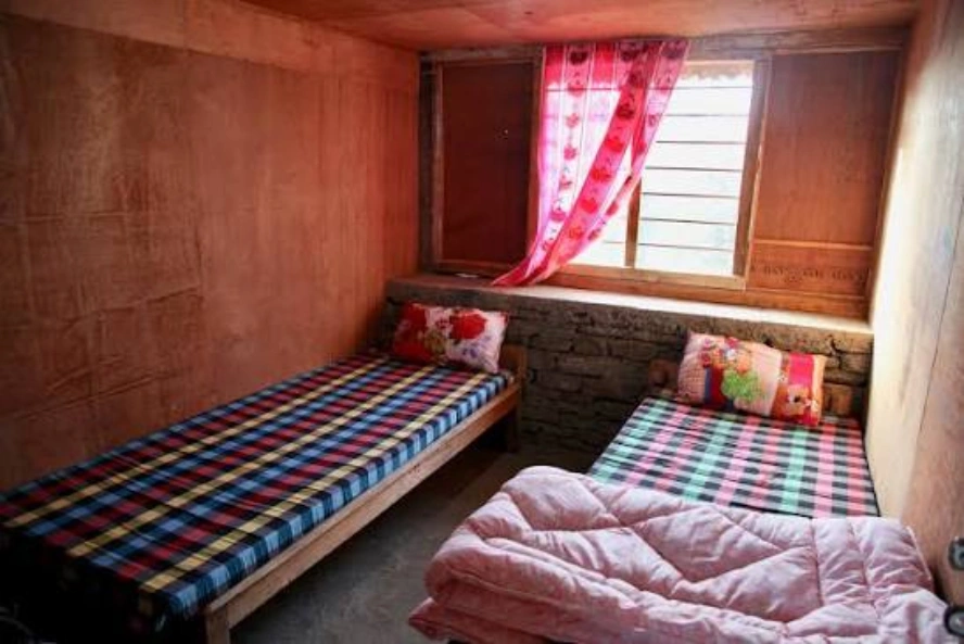
Pheriche teahouses are simple stone lodges with twin rooms, shared bathrooms and one heated dining room where trekkers gather in the evenings. Rooms are basic, usually just beds and blankets with no heating outside the communal dining space. Dal bhat - a plate of rice, lentils and vegetables remains the standard meal though most teahouses also offer soups, noodles and basic Western dishes.
Electricity for charging devices is available but limited, often billed per hour or per device and WiFi is patchy at best, sometimes purchased through prepaid cards. Trekkers should also carry enough cash before arriving since there is no ATM above Namche Bazaar and card payments aren’t accepted this high on the trail.
What Things Can You Do in Pheriche?
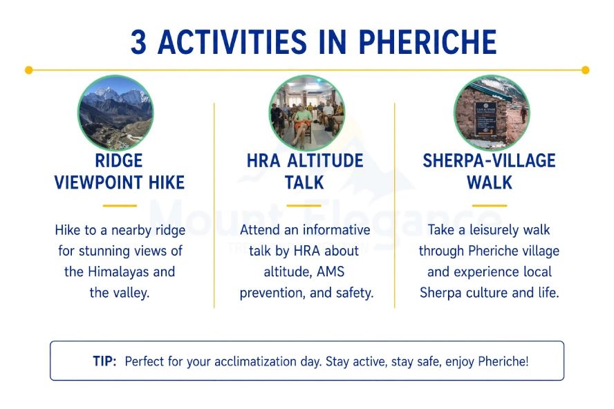
Beyond simply passing through, Pheriche offers a few worthwhile ways to spend an acclimatization day:
- Hiking the ridge viewpoint above the village
- Attending the daily HRA altitude-sickness talk
- Walking through the small Sherpa village
Is There a Climbers' Memorial Site Near Pheriche?
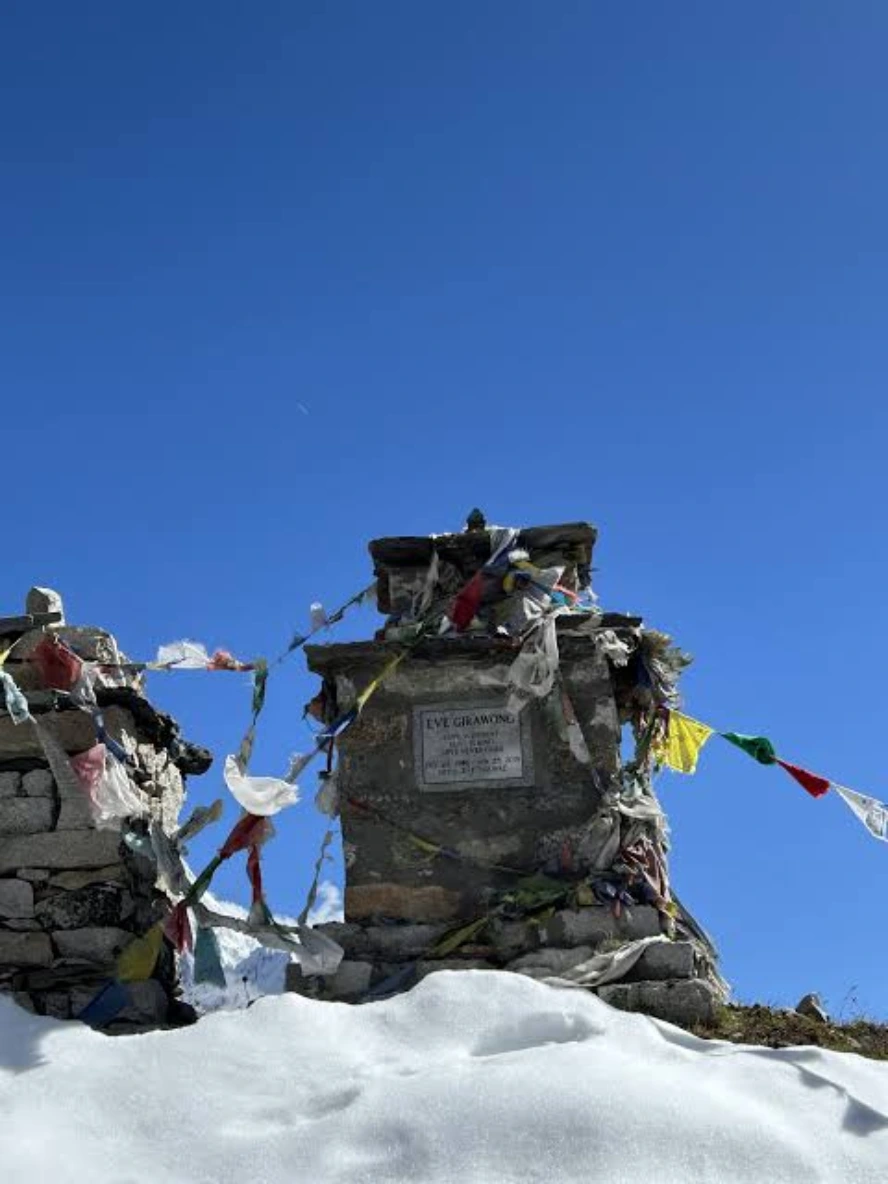
Yes, the Everest climbers' memorial chortens sit at Thukla Pass (also spelled Dughla), about an hour above Pheriche on the trail to Lobuche. The site is not in Pheriche itself but on the higher stretch of trail beyond it. The stone chortens honor climbers and Sherpas who died on Everest and nearby peaks, each marked with a name plaque and set against the open ridge.
How Does Pheriche Fit Into the Everest Base Camp Trek Itinerary?
Pheriche is one fixed waypoint on the classic Everest Base Camp route sitting between Pangboche, below Tengboche and Lobuche above. Its place on the trail is set by geography and acclimatization needs rather than choice which is why nearly rather than choice which is why nearly every standard EBC itinerary routes through it in one direction or another. Some on the way down and some do both depending on which acclimatization path they take through Dingboche or Pheriche.
Rather than a destination in itself, pheriche functions as part of a longer sequence of stops that make up the full trek. The sections below place it within that broader route connecting it to the villages and stages that come immediately before and after.
Does the Everest Base Camp Route Pass Directly Through Pheriche?
Yes - Pheriche sits directly on the classic Everest Base Camp trekking route. For the full day-by-day breakdown of the trek, see our complete Everest Base Camp itinerary guide.
How Far Is Tengboche from Pheriche?
Tengboche to Pheriche covers roughly 9–10 km (5.6–6.2 miles) via Pangboche, a walk of about 4 to 5 hours. The trail loses height briefly after Tengboche before climbing steadily to Pheriche's higher elevation.
How Long Does It Take to Walk from Namche Bazaar to Pheriche?
Namche Bazaar to Pheriche covers roughly 20 km(12.4 miles), usually split across two trekking days via Tengbouche with 10 to 11 hours of walking in total. For the full route breakdown and stops along the way, see our Namche Bazaar guide.
Should You Stay in Pheriche on Your Everest Base Camp Trek?
Yes - For the overwhelming majority of itineraries Pheriche is a required overnight, not an optional stop. Its position on the trail and its altitude make it a natural checkpoint and two things reinforce that: the HRA aid post offers a genuine safety net for anyone showing early signs of altitude sickness and a night here supports the acclimatization process needed before pushing higher toward Lobuche and base camp.
Whether trekkers stay in Pheriche on the way up the way down or both depends on which acclimatization path they take through Dingboche but skipping the village entirely isn’t a realistic option on the standard route. For most trekkers it’s less a matter of choice than a fixed part of getting to Everest Base Camp safely.